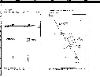
LOCATIONS TO FIND GEMSTONES AND MINERALS IN
QUEENSLAND
When submitting info on locations try and be specific where you can like:
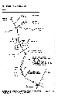
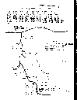
Supply a mud map if you can.MUD MAPS - The following maps are extremely old and
many of these areas may no longer be available to search on or they may no longer yield
any finds. I suppose if you're in these areas it may be worth a search around anyway.
Disclaimer: It is your responsibility to ask permission from any private property owner at
any location when searching for gemstones before you enter any such property. You may
also be required to possess a fossicking license as per state laws.
QUEENSLAND
When submitting info on locations try and be specific where you can like:
- Distance in kilometres from nearest town.
- List and name the turn offs.
- Distance betweens actual turn offs.
- On the road to and from.
- Supply some photos of what you've found and the area itself.
- A description of any familiar landmarks.
- Tools required to suit the area.
Supply a mud map if you can.MUD MAPS - The following maps are extremely old and
many of these areas may no longer be available to search on or they may no longer yield
any finds. I suppose if you're in these areas it may be worth a search around anyway.
Disclaimer: It is your responsibility to ask permission from any private property owner at
any location when searching for gemstones before you enter any such property. You may
also be required to possess a fossicking license as per state laws.
Location To Find Petrified Wood - Chinchilla in Queensland
Directions: Go to Chinchilla in Queensland.
On the road sides about 10 klms out of town in most directions from the town you'll find
small to large pieces of wood with nice color. Most of the areas are closed now that used
to be open but the road sides still yield good results as I found on my last trip there in
2006. Look on the large high road sidings as well as they used the petrified wood as part
of the construction in many areas.
You only need a rock pick just to loosen some pieces and others can just be picked up
along the way.
If you can get access to some of the private properties in the area you may find some
good material but you'll most likely have to dig pretty hard for it.
Also keep an eye open for any roadside piles of rock and aggregate as you'll sometimes
find some nice pieces there as well. There were some huge aggregate piles near the
stock market just out of town and I found some great pieces there as well. I assume they
use this on the roads etc so it may not be there forever. It's a good idea to wear high
rubber boots as many areas have those terrible shaped prickles that stick to your socks
and into your feet.
Always ask permission before entering private property!
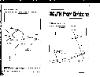
| QUEENSLAND GEMSTONE LOCATIONS |

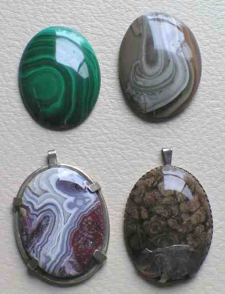
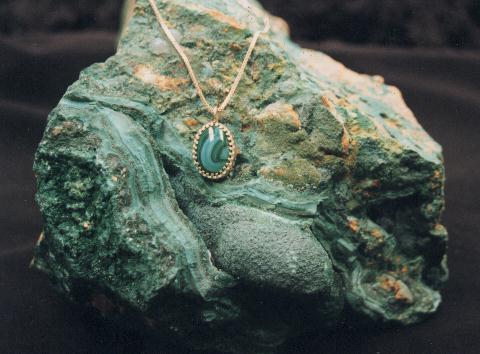
Malachite
Polished and set into a hand
made silver setting.
Polished and set into a hand
made silver setting.
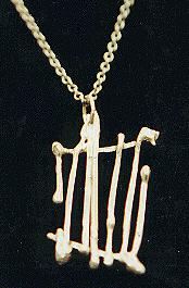
Free Form Silver
There are no limits when
designing jewelry.
There are no limits when
designing jewelry.
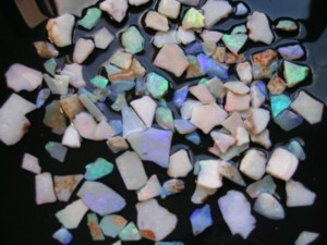
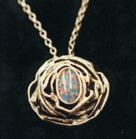
Opals
Cut and cleaned ready for
shaping into designs.
Cut and cleaned ready for
shaping into designs.
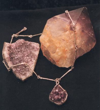
Ameythst
A piece of rough geode set in
silver.
A piece of rough geode set in
silver.
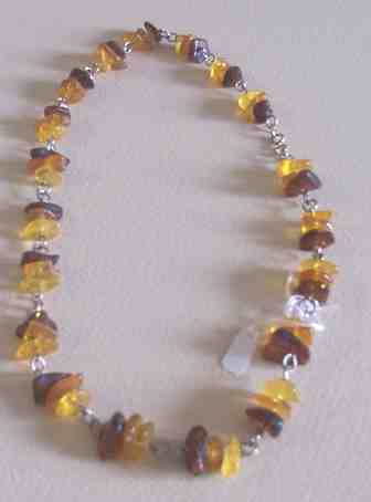
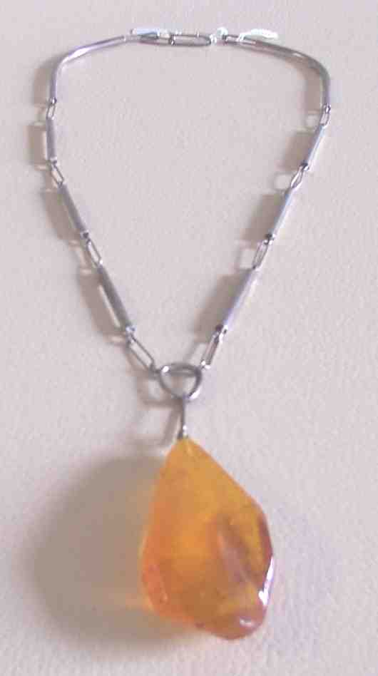
Amber
This fossilized tree resin is
millions of years old.
This fossilized tree resin is
millions of years old.
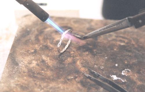
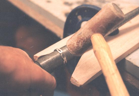
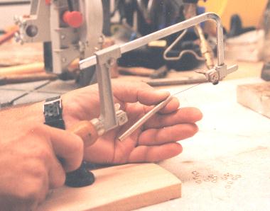
Soldering Silver
Making a ring from sterling
silver.
Making a ring from sterling
silver.
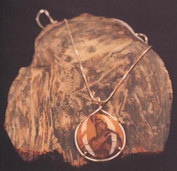
Cabachons
The cabachon design is the
most widely used in jewelry.
The cabachon design is the
most widely used in jewelry.
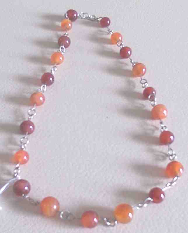
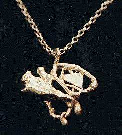
Making Jewelry
Combining jewelry and gems
is an age old art.
Combining jewelry and gems
is an age old art.
Gemstones
Once polished they can be
set into jewelry.
Once polished they can be
set into jewelry.
Coober Pedy Opal Fields
South Australia.
South Australia.
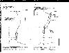
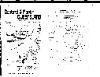
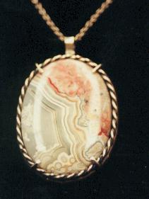
| Redcliffe Peninsula Chalcedony & more |
| Thulimbah Topaz & More.... Swanfels Common Opal |
| Durakai Fern Fossils Crows Nest Petrified Wood |
| Mutdapilly Petrified Wood, more Agate, zircons...... |
| Purga Petrified Wood Wynnum Agate ...... |
| Peak Crossing Opalite & more... Ipswich Agate & More.... |
| Pine Mountain Serpentine & More... Oxenford Jasper |
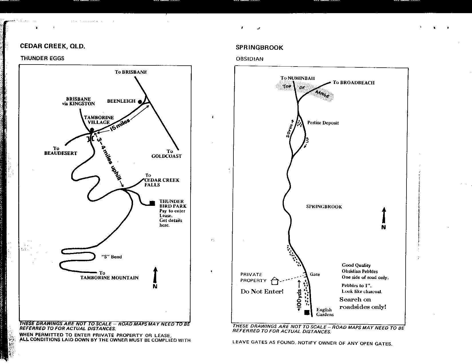
| Cedar Creek Thunder Eggs Springbrook Obsidian |
| Numinbah Valley Jasper, agate 2 maps... |
| Upper Coomera Rhodonite Glasshouse Trachite |
| Wallangara Granite Porphry Rainbow Beach Colored Sands |
| Gatton Petrified Wood, agate Burrandowan Station Sapphires |
| Square Top Mountain Hyalite Blenheim Opalised Wiid |
| Grantham Dendrites Wappa Falls Ryolite |
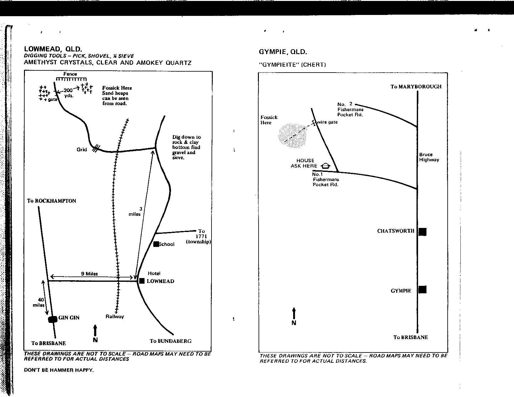
| Lowmead Ameythst & More.. Gympie Chert |
| Biggenden Various Minerals.... Proston Garnets |
| Yuleba Petrified Palm Baking Board Petrified Wood |
| Tomahawk Creek Sapphires.... Rubyvale & Sapphire - Sapphires |
| Willows & Glenalva Sapphires More details etc.. |
| Jordan Gold Fields Gold.... Agate Creek Agate & More... |
| Mt Surprise Topaz |
| Chinchilla Petrified Wood Theodore Shell Fossils...... |


| Chudleigh Park Peridot |

| Cloncurry Ameythst, crystals and |

| Opalton Opal |

| Yowah Opal |
| Moonstone Hill |
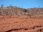
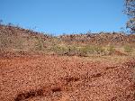
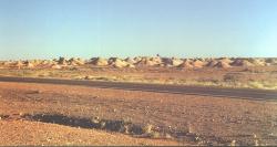
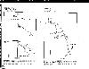
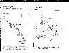
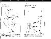
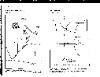
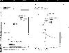
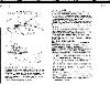
| Go down a bitumen and down the dirt road till you get to a dirt track on the left hand side and To find some crystal geodes go to Malbon and travel 13 km from the start of the travel a half a km till you get to the open clearing. In the hills you can find some crystal geode material. The above photos show the hills that have white outcrops of the crystal material. It's not high grade but some nice specimens can still be found. Colors vary from Amethyst, clear, brown and white. Ribbonstone pebbles can also be found in some of the creeks around this area as well. |
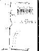
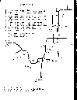
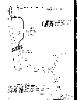
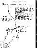
| The above 6 maps are areas between Mt Isa and Cloncurry. |


The following maps and fossicking information has been supplied by the:
Department of Mines and Energy ; Reproduced with permission of the
Department of Mines and Energy, Mining and Petroleum, Level 3 mineral House,
GPO Box 2454, Brisbane, Qld 4001".
* Requires Acrobat Reader
Designated fossicking lands.
General permission areas.
Declared fossicking areas.
The following is a list of declared fossicking areas as at January 2005. Further information
is available from the nearest office of the Department of Natural Resources, Mines and
Water.
Central Queensland
Big Bessie Map (PDF, 46.5 kB)* Fossicking Area (Sapphire)
Located on the central Queensland gemfields, Big Bessie is a small area lying within the
Sapphire Designated Fossicking Land. Though sapphire-bearing shallow wash covering
most of the area has been extensively worked, there are still a few patches of undisturbed
ground left which are likely to contain sapphires. Camping is allowed but regulated to
three months maximum. A Fossickers Camping Permit is required.
Glenalva Map (PDF, 30.6 kB)* Fossicking Area (Anakie)
Located on the Central Queensland gemfields, Glenalva is about 20 km southwest of
Anakie. There is a wide variety of coloured sapphires in the shallow wash covering most
of this area. Camping is allowed but regulated to a maximum period of three months. A
Fossickers Camping Permit is required.
Graves Hill Map (PDF, 46.2 kB)* Fossicking Area (Sapphire)
Graves Hill extends from the south-west corner of the Sapphire Designated Fossicking
Land on the Central Queensland gemfields. Green, yellow and blue sapphires have been
found in the shallow wash which covers more than half of three months. A Fossickers
Camping Permit is required.
Middle Ridge Map (PDF, 55.1 kB)* Fossicking Area (Rubyvale)
Middle Ridge is a small Fossicking Area (32 ha) between the designated fossicking lands
of Divide and Rubyvale on the Central Queensland gemfields. Sapphire and zircon can be
found in the mostly shallow wash of this area. Camping is allowed but regulated to a
maximum period of three months. A Fossickers Camping Permit is required.
Tomahawk Creek Map (PDF, 50.7 kB)* Fossicking Area (Rubyvale)
Although on the Central Queensland gemfields, at 45 km north-west of Rubyvale,
Tomahawk Creek is more remote. There are blue and 'fancy' coloured sapphires in the
generally shallow wash of the area, which may be of many different types. Camping is
allowed but regulated to a maximum period of three months. A Fossickers Camping Permit
is required.
South-East Queensland
Deep Creek Map (PDF, 118.5 kB)* Fossicking Area (Gympie)
Deep Creek lies just off the Bruce Highway at Gympie about 170 km north of Brisbane in
South-East Queensland. Alluvial gold can be found by panning the wash from along the
banks and bed of the creek, especially from the inside of creek bends. Camping is
prohibited on the Fossicking Area. However, hotel/motel accommodation is available in
the town along with caravan parks which provide for campers.
Thanes Creek Map (PDF, 39.6 kB)* Fossicking Area (Warwick)
This is a small area about 40 km west of Warwick and about 160 km south west of
Brisbane in South-East Queensland. Alluvial gold can be found by panning the sediments
within the stream channel and from gravel layers in the low bank or crevices in rock bars.
In dry times, water may be scarce. Camping is prohibited on the Fossicking Area.
However, accommodation and caravan parks are available nearby in Warwick.
North Queensland
Mount Gibson Map (PDF, 310.4 kB)* Fossicking Area (Innot Hot Springs)
Mount Gibson is about 5 km north-west of Innot Hot Springs on the Kennedy Highway
between the small townships of Mount Garnet and Ravenshoe. Fossickers know the area
well as place for collecting gem topaz. Much of the area is strongly mineralised and many
of the creeks and gullies have been worked for alluvial tin. Quartz crystal and cassiterite
also occur. Camping is prohibited on the Fossicking Area but camping and caravan park
facilities and accommodation are available at Innot Hot Springs.
Agate Creek Map (PDF, 259 kB)* Fossicking Area (Forsayth)
Agate Creek is about 340 krn west of Townsville. Access, while suitable for conventional
vehicles in normal conditions, may not be possible during the wet season. This area is
known for agates of superb colour and pattern; chalcedony and thunder eggs are also
found. Agates can be separated from the decomposed lava formations by hand
excavation and from alluvium (soil, gravel) in or near creeks and gullies (usually dry).
Camping is prohibited on the Fossicking Area but is catered for nearby.
O'Briens Creek Map (PDF, 192 kB)* Fossicking Area (Mount Surprise)
O'Briens Creek is located north-west of Mount Surprise which is about 200 km south-west
of Cairns. The main gem variety found here is topaz. Citrine, smoky quartz and
aquamarine also occur in the alluvial gravels. Camping is prohibited on the Fossicking
Area, however, the land owner allows camping at a site nearby where some facilities are
provided.
South-West Queensland
Yowah Map (PDF, 117.1 kB)* Fossicking Area (Cunnamulla)
Yowah is about 100 km west of Cunnamulla in the south-west corner of Queensland. In
this region, boulder opal can be found in siliceous ironstone nodules or 'Yowah Nuts' as
they are generally known. Chips of opal or fragments of ironstone matrix can also be
found by specking the ground surface or digging in shallow ground. Camping is prohibited
in the Fossicking Area. However, accommodation or camping facilities are available
nearby.
Back to top
Designated Fossicking Lands
The following is a list of designated fossicking lands as at January 2005.
Central Queensland
Divide Map (PDF, 471.9 kB)* Designated Fossicking Land (Rubyvale)
Divide lies west of Rubyvale on the Central Queensland gemfields. It is a
sapphire-bearing area, with both shallow and at-depth wash strata. Camping is allowed,
but regulated to three months maximum. A Fossickers Camping Permit is required.
Reward Map (PDF, 217.3)* Designated Fossicking Land (Sapphire)
Reward is west of Sapphire township on the Central Queensland gemfields. Sapphires are
found in both deep and shallow wash strata, with the most popular area on the western
boundary where the wash is shallow. Camping is allowed but regulated to three months
maximum. A Fossickers Camping Permit is required.
Rubyvale Map (PDF, 471.9 kB)* Designated Fossicking Land (Rubyvale)
Located on the Central Queensland gemfields, this fossicking land is situated at
Rubyvale, and extends north and west of the township. Sapphires found in this area are
mostly at depth and extensive mining tenures in the area limit opportunities for fossickers.
However, some tenure holders (if asked) do not object to fossickers scavenging their
tailing dumps. Camping is prohibited within 1.5 km of Rubyvale Post Office, though it is
allowed elsewhere but regulated to three months maximum. A Fossickers Camping Permit
is required. Accommodation or camping facilities are available in Rubyvale.
Sapphire Map (PDF, 471.9 kB)* Designated Fossicking Land (Sapphire)
Located on the Central Queensland gemfields, this fossicking land surrounds the
township of Sapphire. As the name suggests, sapphires are found in this area and are
best developed in the shallow wash from the town towards the northern boundary.
Extensive past mining and numerous mining tenures in the area limit opportunities for
fossickers. Camping is prohibited within 1.8 km of Sapphire Post Office, though it is
allowed elsewhere but regulated to one month maximum. A Fossickers Camping Permit is
required. Accommodation or camping facilities are available in Sapphire.
Scrub Lead Map (PDF, 471.9 kB)* Designated Fossicking Land (Rubyvale/Sapphire)
Scrub Lead adjoins Sapphire and Rubyvale Designated Fossicking Lands on the central
Queensland gemfields. Some of the best blue sapphires have been mined from this area.
However, fossicking is very limited because of the extent of disturbed ground, depth of
wash and current mining tenures. Camping is prohibited within 1.8 km of Rubyvale or
Sapphire post offices. It is allowed elsewhere but regulated to one month maximum. A
Fossickers Camping Permit is required. Accommodation or camping facilities are available
nearby.
Willows Map (PDF, 34.1 kB)* Designated Fossicking Land (Willows Gemfields)
Willows is located about 30 km southwest of Anakie on the Central Queensland gemfields.
Sapphires found here are mostly yellows and greens, though zircons and rare diamonds
have also been found. Gems occur in shallow wash, with the favourite spots reasonably
close to town. Camping is prohibited, although there are caravan parks and camping
facilities available in the township.
Western Queensland
Opalton Map (PDF, 188.1 kB)* Designated Fossicking Land (Winton)
Opalton is located about 100 km south south-west of Winton in central-western
Queensland. Boulder opal can be found in the spoil dumps of old workings and shallow
ground. Camping is allowed but regulated to three months maximum. A Fossickers
Camping Permit is required. A private campsite with toilets, shower and water is nearby.
South-West Queensland
Duck Creek Map (PDF, 112.7 kB)* Designated Fossicking Land (Quilpie)
Duck Creek is located about 100 km south south-east of Quilpie in South-West
Queensland (Sheep Station Creek is in the same vicinity). Boulder opal is found in this
area in ironstone concretions (boulders) or as chips and fragments. Small-scale hand
mining under mining claims is currently carried out in this area. Camping is allowed but
regulated. A Fossickers Camping Permit is required.
Sheep Station Creek Map (PDF, 112.7 kB)*
Designated Fossicking Land (Quilpie)
Sheep Station Creek lies south-south-east of Quilpie in South-West Queensland. In this
area, boulder opal occurs in ironstone concretions (boulders) or as chips and fragments
in spoil dumps. Small-scale hand mining under mining claims is currently carried out in this
area. Camping is allowed but regulated. A Fossickers Camping Permit is required.
Back to top
General Permission Areas
The following is a list of general permission areas as at January 2004.
Before visiting any general permission areas, detailed information about what conditions
apply to each area should be sought from the Mining Registrar at the District Office of the
Department of Natural Resources, Mines and Water for the mining district in which the
area is located.
Brisbane Mining District
Swipers Gully Map (PDF, 112.4 kB)*
(Passchendaele State Forest SF263 Stanthorpe)
Swipers Gully is located in the Passchendaele State Forest (SF263) about 15km
northwest of Stanthorpe in South East Queensland. The gems topaz and smoky quartz
have been found in this area.
Chinchilla Map (PDF, 72 kB)*
Chinchilla, which is about 250km west northwest of Brisbane in South East Queensland is
a popular collecting locality for good quality petrified wood suitable for ornamental and
lapidary use.
Emerald Mining District
The old gold mining district surrounding Clermont attracts interest from fossickers and
metal detector enthusiasts. There are a number of separate areas available. These are:
Clermont Map (PDF, 48 kB)*
Black Ridge Map (PDF, 29 kB)*
Bathampton Map (PDF, 46.7 kB)*
Birimgan Map (PDF, 110.7 kB)*
Bottom Apsley Map (PDF, 63.0 kB)*
Town Reserve Map (PDF, 34.0 kB)*
McDonalds Flat Map (PDF, 40.5 kB)*
Four Mile Map (PDF, 73.8 kB)*
McMasters Map (PDF, 121.3 kB)*
Museum Reserve Map (PDF, 33.0 kB)*
(Click on links to view separate area maps in PDF format). They are located in state
forests or reserves, and special conditions apply.
Georgetown Mining District
Moonstone Resources Reserve Map (PDF, 347.2 kB)*
Moonstone Hill is located adjacent to the Kennedy Development Road about 90km south
of The Lynd. Gem quality feldspar 'moonstone' occurs at this locality.
Mount Isa Mining District
Castle Mount (Cloncurry)
Castle Mount is about 100km south of Cloncurry in North West Queensland. Amethystine
quartz is found at this area.
Kuridala (Cloncurry)
Kuridala is located about 65km south of Cloncurry in North West Queensland. Amethyst is
found at this location.
Top Camp (Cloncurry)
Top Camp is located about 20km east of Cloncurry in the Fisher Creek area of North
West Queensland. Alluvial gold is found at this location.
Wee McGregor (Cloncurry)
Wee McGregor is situated about 12km south of the deserted township of Mary Kathleen
between Mt Isa and Cloncurry in North West Queensland. Staurolite 'maltese crosses' can
be found in this region.


Tips & Safety On Field Trips
Disclaimer: It is your responsibility to ask permission from any private property owner at any location
when searching for gemstones before you enter any such property. You may also be required to
possess a fossicking license as per state laws.
Safety In The Workshop
- Take every precaution while on field trips like making sure you have the right gear like gloves,
boots, drinking water and basic supplies. - Fill in your holes after digging and beware of overhanging rocks and ledges that could collapse
while digging below. - Don't go into old mine shafts as most are unstable and air quality can never be guaranteed.
- Always wear safety glasses when breaking or chiselling on rocks.
- Watch out for snakes and spiders because as a rock hound you're more prone to finding these
critters than others. - Always close gates after you and always take your rubbish home with you if there isn't a proper
place to leave it. - Always tell someone where you are before you leave in case something goes wrong!
- Always have a first aid kit close by.
- If you haven't been to an area before draw yourself a map or have a map with you so you don't
get lost. Mobile phones don't work everywhere! - Wear a good hat and sunscreen so you don't get sunburnt.
- Never forget: FOOD, SNACKS, DRINKS & MEDICATION.
Disclaimer: It is your responsibility to ask permission from any private property owner at any location
when searching for gemstones before you enter any such property. You may also be required to
possess a fossicking license as per state laws.
Safety In The Workshop
- Don't have loose clothing around any moving machine parts and keep guards on equipment at
all times. - Wear safety glasses while grinding and using any pickle or acid compounds.
- Wear a filter face mask if required.
- Don't spill water on any electric motors. Electricity and water don't mix.
- Keep fingers and hands clear of sharp moving parts.
- Wear rubber gloves if handling any acids or pickling solutions.
- Use tweezers when handling hot soldered jewelry.
- Have a first aid kit near by at all times.